Saturday 28 July 2012

Ladakh Diaries 2 - Manali to Leh, Day two

We continue our adventure in the hills of Ladakh. If day one of our journey was memorable, day two turns out to be charming. 

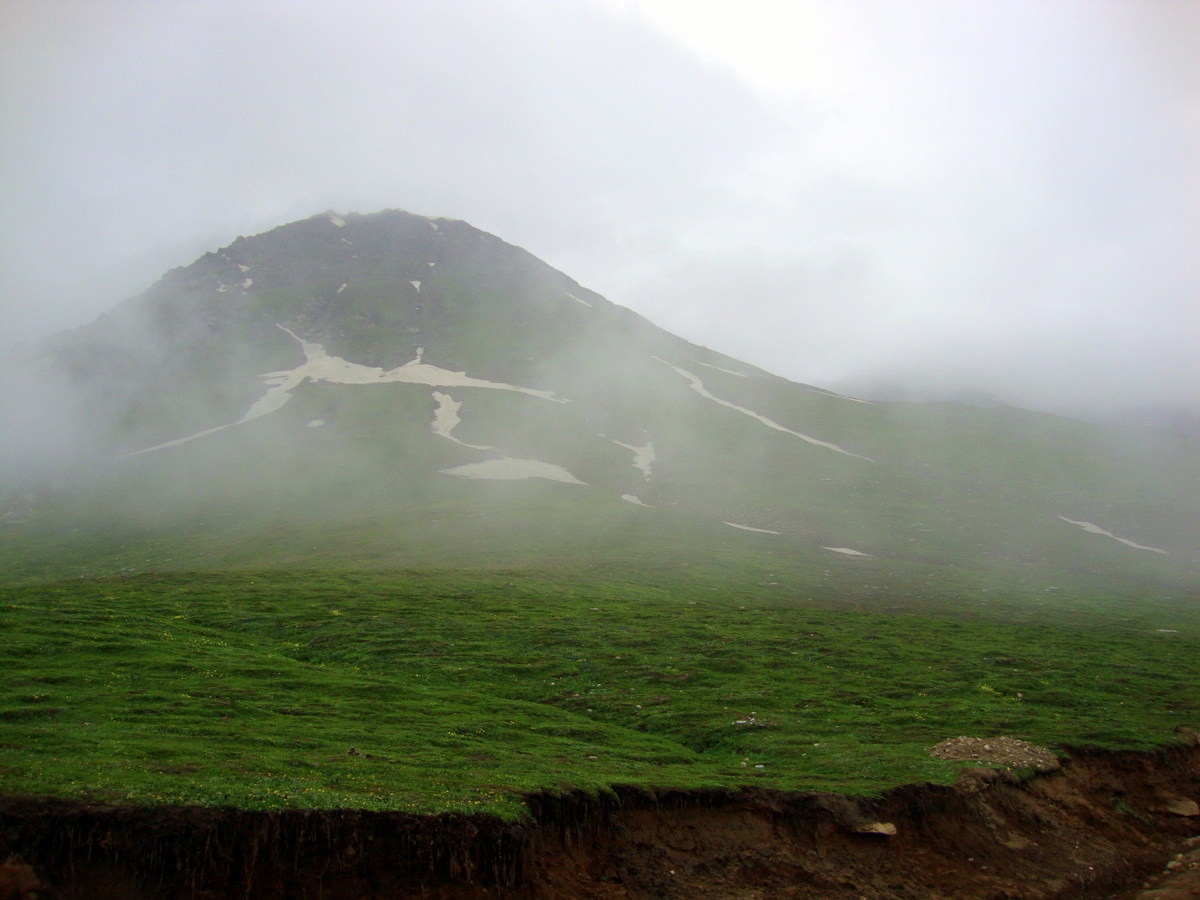
Sarchu @ 14,000 feet is a high altitude destination in itself. The altitude, strange yet beautiful surroundings and mild AMS kept us awake the whole night at Sarchu. Even the sun did not miss out on the beauty of this wonderful place and was up and running at about 4.30 AM!

 We were ready for the second day’s experience by 6 AM.


Mesmerising morning colours as we leave Sarchu

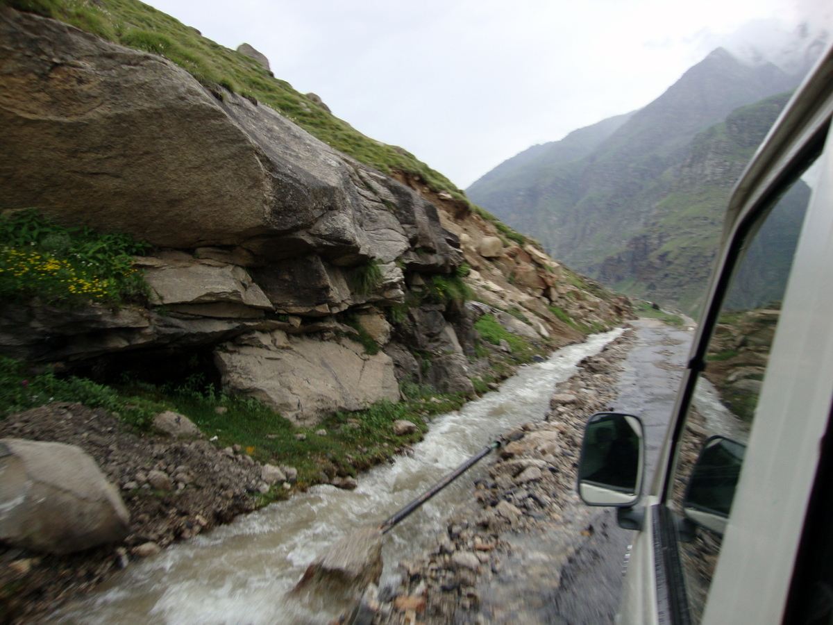
As we leave Sarchu, Tsarap Chu river gives us company. We drive along side the river. We cross the river which has created canyon like structures all along its course.


The road and landscape turn barren and desert like with snow capped peaks at distance


You see the canyon like structures which are nothing but wind weathered sand dunes


Pang is the last habitat of Army establishment you see till you reach on the outskirts of Leh

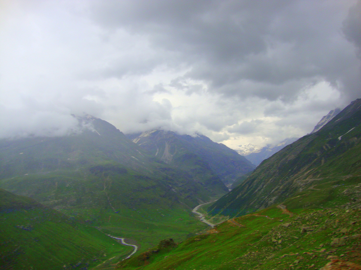
The road begins to climb again. We leave Pang and cross Nakee la and Lachlung la Passes and notice the terrain changing into desert like as we enter the vast plains surrounded by mountains. We find ourselves in a “wild west” kind of a landscape where we see rocky outcrops, natural arches and tall mountains.


Barren landscape looks beautiful with snow capped peaks in the horizon

Brinda @ Nakee La

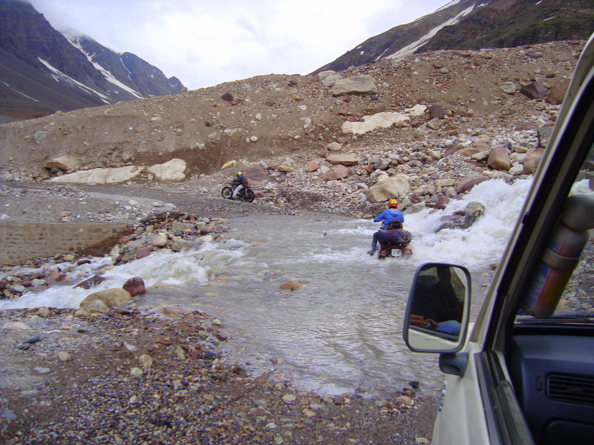
Crossing Tsarap Chu waterway as a convoy


From Pang it is all along climb till Nakee La


The landscape is so barren it resembles wild west of USA


Natural Sand arch - Nature at its best 


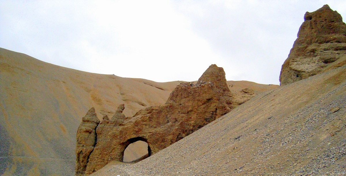
Close up shot of Sand Arch


Streams flowing between huge rocky terrain


This stretch is just beautiful - look at the sculpted sand walls


Sculptured sand walls


Moreh plains.......extending for miles


We leave Moreh plains behind and head for our final climb is towards Tanglang la, which is over 17,000 ft. This is a continuous, relentless climb. This is the second highest motorable pass in the world. You can feel the rarefied atmosphere here where the oxygen content is less in atmosphere which makes you tired very fast. 


The ascent begins


Breathtaking landscape as the ascent to Tanglang La begins


Brinda @ Tanglang La - Second highest motorable pass in the world

As soon as we start our descent towards Leh, we find “Indus” river flowing all along till Leh. The mountains suddenly become more colourful and we find shades of red, amber, violet and brown. It is like driving through a multi coloured tunnel.The Indus brings with it more life and green and we find mustard fields and other crops in the valley.


From Tanglang La it is descent to Leh. You are given company by fast flowing Indus river and the mountains turn colourful.


Mustard fields in Indus valley 

We now get a glimpse of “gompas” on hilltops and the mountain air seems to carry with it soothing “Buddhist chants”. The road towards Leh becomes more desert like and we notice “white chortens (stupas)” at various places on the road. The army camps make an appearance and the road is now “alive” with long convoys of army vehicles which are moving towards Leh and Kargil. After Upshi, Karu, Thiksey and we enter Leh.


Welcome to Leh

As we sip tea in a cafe in Leh, we could not help but recall the beautiful moments on the road- the memory of this drive will linger along for years after the road has gone - It’s an experience of a lifetime!

Post Script

Manali - Leh road journey is one of the beautiful one can think of. Travel to Ladakh can not be complete if you do not experience this journey. You cross four passes of different heights, you go through snow, streams and precariously narrow stretches at places. The landscape changes every few KMs. It is a photographer's paradise indeed. We did the trip in two days and i highly recommend it be done in three days (details in my previous post on this road trip).

Please look at travel tips given on my previous post Ladakh Diaries 1 - Manali to Leh, Day one and be well prepared. Always keep a buffer day when you plan for this trips as there may be chances of landslides or snow blocking the passes.

Glosaary

Gompas - Buddhist monasteries
Chorten - Stupa

Also see


Did you like this post? Do you need help in planning a trip to Ladakh and Manali? Please write to poorna62@gmail.com.

Happy to help Smile 

Share the post

If you enjoyed reading this post, please take a moment to click on buttons below and tell the world!

Saturday 21 July 2012

Monsoon in Western Ghats in India - Itinerary to experience it

This is time for Indian Monsoons. This is also the best time to see Western ghats and experience rain especially in the Malnad region of Thirthahalli in Karnataka. It is still unexplored and receives the second highest rainfall in India. This is THE place for someone who wants to experience Indian monsoons in full glory.

I would recommend you to make Thirthahalli as base (Thirthahalli ) - it is centrally located and has good stay options - and you can comfortably plan for four to five days of outing. It is a sleepy little town in rural Karnataka. Thirthahalli and its surroundings is also an area which receives heavy rain fall.

Having been to Thirthahalli and surroundings many times, here is a recommended itinerary. Of course, this region can be visited throughout the year if you don't want to get wet in the torrential rain! The season between October to March is the best when there is a nip in the air, mist on the mountains and a chance to see glorious sunrises and sunsets.

This itinerary is basically for a road trip from Bangalore. If you don't intend to drive, don't worry. You have an excellent option of taking a night train from Bangalore to Shimogga and ask your host to arrange for a pick up at Shimoga railway station. Shimoga to Thirthahalli is a beautiful and picturesque drive of an hour. If you are a person who loves bus journeys, you have option to catch a direct night bus from Bangalore to Tirthahalli.

Day 1 - Bangalore - Thirthahalli

Total Distance - 339 KMs

Route Map - Bangalore - Tirthahalli
  • Leave Bangalore in the morning and reach Tirthahalli for Lunch. 
  • It is a comfortable six hours drive. 
  • Have breakfast enroute either at Tiptur (Kamat Restaurant) or Arsikere (Raghavendra Lodge) or Kadur (Vinayaka Cafe) or Birur (Preethi Canteen). 
  • On the way visit Amritapura - five KMs from Tarikere - for its famous Hoysala temple. 
  • In the evening go around Tirthahalli town, visit Bheemanakatte for a quiet evening by Tunga river. 
Useful links

Amritapura - Amrutesvara Temple, Amruthapura - Wikipedia, the free encyclopedia

Day 2 - Tirthahalli - Kundadri - Agumbe - Thirthahalli

Total distance - 80 KMs

Route Map - Tirthahalli - Kundadri - Agumbe - Tirthahalli
  • Experience the fury of rain and wind on Kundadri - A Small hillock on the way to Agumbe. You can drive up the hill and enjoy panoramic view. You may take a look at Kundadri pictures in my earlier post on Monsoon drive. 
  • Visit Agumbe Rain Forest research station and learn about King Cobra and wild life in Western Ghats 
  • Enjoy the cascades of Jogi gundi and Koodlu Theerta waterfalls 
  • Walk on the streets where Swami and his friends walked in Malgudi Days 
  • Return back to Tirthahalli in evening. 
  • You may not be able to see beautiful sunset at Agumbe during monsoons which is possible in winters and summer 
Useful links
More Kundadri pics - deepsan: Magical morning at Kundadri Betta

Agumbe - Agumbe - Wikipedia, the free encyclopaedia

Agumbe Rainforest research station - ::.Agumbe - Rainforest Research Station

Malgudi Days - Malgudi_Days

Day 3 - Thirthahalli - Sringeri - Horanadu - Kuppali - Thirthahalli
Total distance - 185 KMs

Route map - Tirthahalli - Sringeri - Horanadu - Tirthahalli
  • A beautiful drive. 
  • Have early breakfast in the place of your stay or better have a good South Indian breakfast at Sringeri. Visit historical temple of Goddess Sharada 
  • Walk over the bridge on Tunga river and visit Shankaracharya's Ashram - don't miss seeing Award winning architecture of Sanskrit Pathashala. 
  • Drive to Horanadu. Visit the famous temple of Goddess Annapoorneshwari at the foot hills of mountains 
  • Have lunch in temple. 
  • After lunch drive back to Tirthahalli and on the way after Koppa, visit the beautifully restored heritage house of great Kannada poet KUVEMPU as a memorial for him at Kuppali - good signage is there. Trek to "Kavi Shyla" a small hill - ten minutes trek - adjoining to the memorial to see "Stone Henge" kind of structure done by well known artist K T Shivaprasad. 
  • Enjoy the beautiful view of Sahyadris from the top. 
  • Return back to Tirthahalli 
Useful links

Kuppali - Kuppalli - Wikipedia, the free encyclopaedia

KUVEMPU - Kuvempu

Sringeri - Shringeri - Wikipedia, the free encyclopedia

Day 4 - Thirthahalli - Kollur - Thirthahalli
Total distance - 167 KMs

Route map - Tirthahalli - Kollur - Tirthahalli
  • After early breakfast drive to Kollur. 
  • Enjoy the beautiful drive through mountains/valleys 
  • Visit temple dedicated to Goddess Mookambika. 
  • Return to Tirthahalli for late lunch 
Day 5 - Tirthahalli - Kavaledurga - Mani dam - Nagara Fort - Tirthahalli
Total distance - 114 KMs

Route Map - Tirthahalli - Kavaledurga - Mani Dam - Nagara Fort - Tirthahalli
  • Kavaledurga is a hillock fort close to Tirthahalli with amazing views of Mani dam backwaters and valleys. 
  • After break fast head towards Kavaledurga. 
  • Climb the the hill fort - it has steps - enjoy the views. 
  • Drive to Nagara fort 
  • Drive to Mani dam on the way back and view beautiful backwaters formed by the dam. 
  • Return to Tirthahalli for late lunch. 
  • After lunch and rest visit Chippalagudde, a picnic spot on Tunga river 
Useful links

KavaleDurga - The Voice of Greenery: Kavaledurga

YouTube Video on Kavaledurga

Mani Dam - The Voice of Greenery: Kavaledurga

Nagara Fort 

YouTube video on Nagara fort

Day 6 - Tirthahalli - Kodachadri - Tirthahalli
Total distance - 138 KMs
Route Map - Tirthahalli - Kodachadri
  • Trekking of Kodachadri in Monsoons is only for experienced trekkers. 
  • Also visit beautiful Hittalamane falls at the foot hills. 
  • In non monsoon season, one can enjoy amazing sunset from this peak. 
Useful links

Kodachadri - The Voice of Greenery: Search results for kodachadri

Day 7 - Thirthahalli - Mandagadde bird sanctuary - Sakrebylu elephant camp - Gajanur dam - Tyavarekoppa Lion safari - Thirthahalli

Total distance - 140 KMs

Route Map - Tirthahalli - Shimoga - Tirthahalli
  • This can be done as a comfortable day trip. This trip is specially for Kids who will enjoy bathing elephants and see lions and tigers at close quarters. 
  • Leave early with packed breakfast. 
  • Visit Sakrebylu elephant camp. Watch how the mahouts bathe and train elephants. Allow kids to play with some baby elephants including bathing them 
  • After breakfast, drive to Tyavarekoppa lion safari which is ten KMs from Shimoga. On the way stopover at Gajanur dam to enjoy beautiful vistas of backwaters of Tunga river 
  • Enjoy lion safari and have lunch in Shimoga. Visit Shivappa Nayaka's palace in city. 
  • Drive back to Tirthahalli. 
  • Stop over at Mandagadde bird sanctuary on the way for some bird watching 
Useful links

Mandagadde - Mandagadde Images

Sakrebylu - Sakrebylu Images

Day 8 - Thirthahalli - Sagara - Jog falls - Thirthahalli

Total distance - 220 KMs

Route map - Tirthahalli - Jog Falls - Tirthahalli
  • After breakfast drive to Jog falls, the tallest water falls in Asia 
  • On the way back visit famous temple at Ikkeri on the outskirts of Sagara. 
  • Have lunch in Sagara. 
  • Return to Tirthahalli 
Useful links

Jog Falls 

          Wiki - Jog Falls

          Google Images - Jog Falls

Ikkeri - Aghoreshvara Temple @ Ikkeri

Day 9 - Return to Bangalore after Breakfast

Interesting Deviations
  • If one wants to visit Udupi, then they can deviate from Agumbe or Kollur.
  • If one wants to Murdeshwar and beyond, one can do so after Jog falls. Also there is a nice trek of Kanur fort from Jog falls for which one has to stay near Jog falls.
Travel Tips
  • Tirthahalli and surroundings experience heavy rainfall during monsoon. Take proper rain gear. 
  • Make sure your car is in good condition. Check condition of tyres. 
  • Always check locally for latest road condition. Your host will be of help. 
  • You can hire a car at Tirthahalli for doing different trips. 
  • Plan your itinerary based on number of days you can spare. 
  • While trekking or walking in monsoon, you may suffer leech bite. Don't worry. It is a minor hiccup. 
Stay Options

There are good home stays in and around Tirthahalli which provide nice accommodation with excellent meals. We have stayed at Bananki (www.bananki.com) and the Malnad cuisine served by them is awesome. A very good home stay.

For more stay options, you may visit Travelmalnad which lists home stays in Tirthahalli.

Glossary

Malnad - Is a shortened form of "Maley Nadu" meaning the region with rainfall. "Maley" in Kannada Language means Rain

Western ghats - Mountain ranges in peninsular India. A UNESCO World heritage site.

Hoysala - Medieval dynasty who ruled vast parts of South India. Famous for building artistically brilliant temples.

Malgud Days - Iconic Indian television serial

Ashram - Monastery

Pathashala - School

Sahyadri - Another name for Western Ghats

Mahout - Elephant trainer


YTWRR7R2CE7G 


Did you like this post?  Do you need help in planning a trip to Tirthahalli and Malnad to experience Indian Monsoon? You are welcome to write to me at poorna62@gmail.com.

Happy to help icon7.gif

Monday 16 July 2012

Ladakh Diaries 1 - Manali to Leh, Day One


This is the time to Travel to Ladakh. We did it exactly two years back and it was a journey of our lifetime. Hop on with us as we take you around the "Cold Desert" in all its pristine glory.........

“It’s breathtakingly beautiful” – we told our friends as soon as we reached Leh after the spectacular journey of 473 Kms on the Manali - Leh road. Being fed up of the rush hour traffic to office and back, having lived all along in an urban set up, this “Big Trip” gave us all the thrill and excitement which we could not dream existed. The road clings and wriggles through some of the most spectacular terrain in the world- crossing four high passes, fords, streams and tumbling mountain surfaces!

Our journey started from Manali on a cold rainy morning. We were ordered (!) by our Driver Sumit Singh  on the previous day to be ready at 6 AM to leave Manali. The wisdom of driving in Himalayas is "Leave early and Reach early" as you can not depend on the fickle mountain weather.

Johnson Hotel Manali
In front of Johnson Hotel, Manali
Being our first trip in the Himalayas, ascent upwards unfolded a lot of surprises - the omnipresent apple trees with “red juicy” apples, the streams which gently flow down the tall mountains creating numerous waterfalls, the green carpet of trees and plants in the valley, the clouds which gently seem to caress the mountain peaks was a “visual” poetry which can be best seen than written. The road from Manali to Rohtang is an ascent and is surrounded by beautiful valleys. Let the pictures tell the tale.
Manali
Beas River, Manali

Manali

Manali

Manali
The Landscape is spectacular with steep cliffs, lovely conifers, streams tumbling down as waterfalls......


The road till Rohtang has heavy traffic and is prone to mud slide as the surface is soft

Our car slowly climbed towards the snow-capped Rohtang Pass only to wait behind a “Kilometer long” pile up of cars due to a “mudslide”. We had a long journey ahead as the plan was to stay overnight at Sarchu at - 13000 feet - which is approximately 150 KMs from Rohtang.


Chai being by a vendor on the roadside as we waited for the road to ........refreshing in cold environs indeed
Employees from Border Road Organization were summoned from Manali to help clear the “mud slide” and when our car cleared this hurdle, we had lost about 2 hours of precious time.

Having had breakfast at Marhi, our journey resumed towards Sarchu. We did not stop at Rohtang - the place where the day trippers from Manali - majority of them newly weds - gather to play in snow. Some glimpses of Rohtang landscape.


First sight of snow!!
Some Wild flowers too...
The journey beyond Rohtang was suddenly silent. The only noise we could hear was the air rushing against the mountain or the tip – tap of the melting snow or the screech of the car tyre on the road or sometimes when a "Bullet rider" overtook us with that "Thumping" sound. The road was sometimes “cemented”, sometimes a “patch of mud” or sometimes “a path through a running stream” . Very soon the green valleys and mountains were replaced by shred of brown and rust and the snow peaks lingered in the background. Driving along the Bhaga River and listening to its different notes transformed us into a different world. We could see many water falls with water trickling away under the sheets of snow above, valleys capped with snow, rocky mountains painted green by wild grass and flowers.....

The landscape turned more beautiful as we drove in the Bhaga valley surrounded by mighty mountains with lush green covers, waterfalls......


Bhaga river giving us company


Fill up your tanks folks, lest you will be stranded!!


The ascent to Barlacha La starts after crossing the bridge


River or road??


Army and Border Road Organisation on the way


We cross Thandi and Jispa  - last villages - and begin our ascent again towards Baralacha la which is at about 16500 ft. The journey was an absolute delight. Beautiful and pristine Suraj tal lake and the winding snow capped roads , the low hung clouds with sun breaking in between and creating a beautiful rainbow, we could not just take our eyes off the road. We wished we had a 360 degree vision. Barlacha la was white sheet spread out in every direction and made us sway between dream and reality!


Adventure on the bikes!!
Beautiful Barlacha La all the way from now on


Pristine Suraj Tal


Sarchu is where we find tents pitched in the pristine valley of the mighty mountains…for a city bred person, having to stay and sleep amid these mountains and listening to the noise of the winds and the gentle noise of the rain/dew/snow on the tent was a surreal experience.

Camp site @ Sarchu

TRAVEL TIPS

Getting there

The journey to Leh by road starts at Manali. Hence make Manali as a base.

By Road

a) There are overnight buses from Delhi to Manali. One can book the luxury Volvo buses run by Himachal Pradesh Transport Corporation from Delhi to Manali.


By Train

The nearest railway station is Chandigarh. If you are coming by train, then the convenient station will be Chandigarh. Unless, you want to visit Chandigarh, i would recommend you to take the bus as mentioned above.

By Air

The nearest airport is at Kullu which is around 40 KMs from Manali. The flights to Kullu from Delhi are notorious for cancellation/delay due to weather condition in Kullu. Keep this in mind while booking your plane tickets.

Stay Options

There are many options to suit all budgets. We stayed in Johnson Hotel which is one of the oldest in Manali and regarded as an institution. Huge and excellent rooms with a laid back atmosphere. The continental restaurant in the hotel is one of the best in Manali.


Other information


a) This trip is not for faint hearted. You really need to rough it out on the treacherous roads. So be prepared mentally and physically!! Also this trip may not be suitable for young children below ten years as they may get affected by Acute Mountain Sickness. For details on Children and High altitude, please take a look at this National Institutes of Health, USA link

http://www.ncbi.nlm.nih.gov/pmc/articles/PMC1112806/ 

b) Remember that you will be driving from a height of 6000 ft in Manali to close to 18000 in Tanglang La.  Acclimatisation is the key. Else, AMS - Acute Mountain Sickness - is likely to hit you at these heights. Most of the cases will be mild and result in nausea, headaches, sleeplessness.


c) Though the trip can be done in two days, we recommend doing it in three days with overnight stay in Keylong and Pang. This will help one acclimatize better and fit and raring to go once you reach Leh.

d) Driving in hills takes more time and speeds are drastically reduced as road condition is not good. Always have buffer time to allow delays due to landslides and flooding of roads. Land slides are particularly common between Manali and Rohtang.

e) Doing the trip in three days will also help you stop and savour the beauty around. This will also give you time to take a detour to Tso Kar a beautiful lake in wilderness closer to Moreh Plains.

f) Our advice is to hire the local transport to do the trip. The roads are narrow and bad. The driver will not be able to enjoy the ride as his eyes will be fixed on the road. We have seen bikers on the road and we do not advise unless you are interested in adventure alone. Believe us; the guy who drives the vehicle - bike or car - will not be able to enjoy the drive. If you still want to drive your own car, make sure it is an SUV or a car with good ground clearance. 

g) Fill up fuel in Manali and carry supplies in Jerry cans. There is only one petrol bunk in Thandi and if it runs out of stock you will curse yourself. Diesel may be available in "black" at exorbitant cost but getting petrol will be difficult.

h) Follow the golden rule of hill driving. Start early and reach early!

i) Carry enough memory cards for your pictures. There is so much to click that you will regret if you haven’t had these chips.

j) Eat less and don’t overfill yourself while driving in hills. Drink lot of water.

k) Carry a good medicine kit. Talk to your family doctor and take necessary medicines.

l) Do not exert and run around in high altitude. Oxygen content in atmosphere is 30 - 40 percent lesser in these areas and will make you tired and sick. Do not stay for more than 10 minutes in passes above 15000 ft

m) Carry a good Binocular

n) Pack your long johns and woolens. You require them at these tented camps where the temperatures fall to 5 deg. If you have a sleeping bag, carry it.

o) Ensure that you have the complete vehicle accessories and kit. If self driving, practice trouble shooting techniques and become confident. Carry a good map of the area.

p) Dal – Chawal , Maggi and Omelets are staple food you get in dhabhas  on the way. Don’t expect anything more!

q) If possible try and plan your drive during full moon day period. You will possibly see the brightest moon ever in these rarefied and unpolluted areas at night in tented camps.

r) Do not rely too much on your cell phone. It may not work most of the time.

s) Do not sleep on the journey. You will regret having missed on some of the outstanding scenery in the world.

t) Lastly, if you get stuck up anywhere and find an army camp close by, go in and take their help. These great guys will never say NO. I can vouch for it having served in Indian Army!!

u) We would recommend that spending one day in Manali will help in seeing some nice places around and also prepares you for the long journey. The transport for the drive can be hired in Manali. The transport charges are generally expensive and it will be good to have at least four people travel in the taxi to reduce the cost burden.

v) It is recommended to go through a recognised tour operator who will ensure all arrangements are made on the way. We did the trip with Ladakh Safari who are very good.  Here is their website and you can get details here.


Related posts on Ladakh in this blog 


Glossary

Dal - Chawal - Spicy lentils and Rice
Dhabha - Shack
Chai - Indian readymade tea made with milk, sugar and spices
La - Ladakhi word for "Mountain pass"
Tal - Lake

Did you like this post? Do you need help in planning a trip to Ladakh and Manali? Do write to us. Happy to help Smile 

Share the post

If you enjoyed reading this post, please take a moment to click on buttons below and tell the world!